How to Make an Interactive 3D Globe Map Online
Turn your map into a spinning 3D globe: switch on globe view, pick the space colour and atmosphere glow, colour countries, add data, then share or export it.
Updated · by the mapbow team
A globe map shows the earth as it really is: round. Zoomed out, the map becomes a planet you can spin; zoom in and it turns smoothly back into a normal flat map. Globes are the honest way to show world-scale data – countries, offices around the world, global travel – because they do not stretch the far north and south the way flat web maps do. In mapbow the globe is one switch, it is free on every map, and it works with everything else you put on the map.
Making a globe map step by step
- Turn on Globe view. Open Style and, under 3D & globe, switch on Globe view. Zoomed out, the map becomes a planet you can spin; zoom in and it flattens into a normal map.
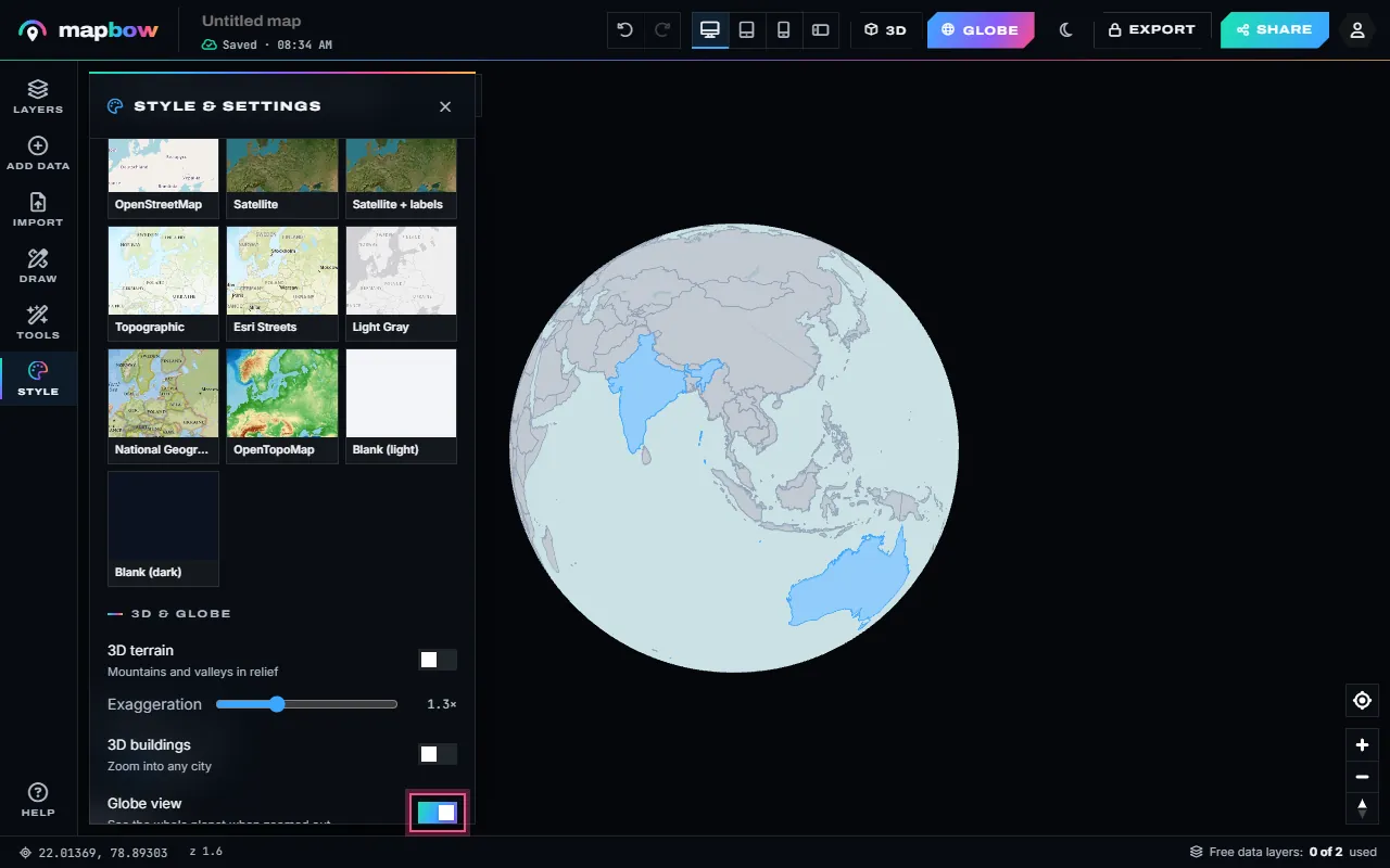
Step 1 Style › Globe view. - Choose the space colour. Under Space around the globe pick a colour - deep space, midnight, indigo, black, white, paper, sky or sand - or any colour with the picker. Atmosphere glow adds a soft halo.
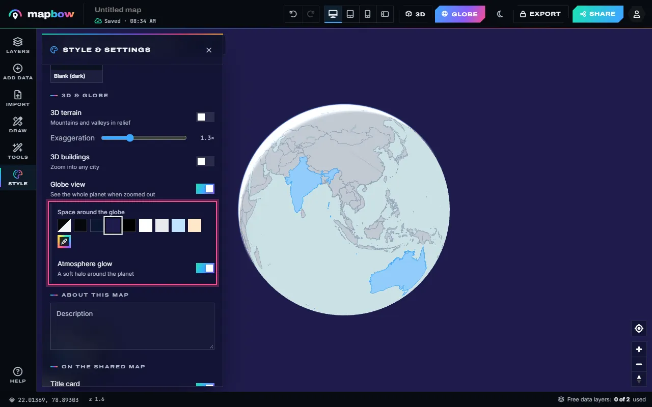
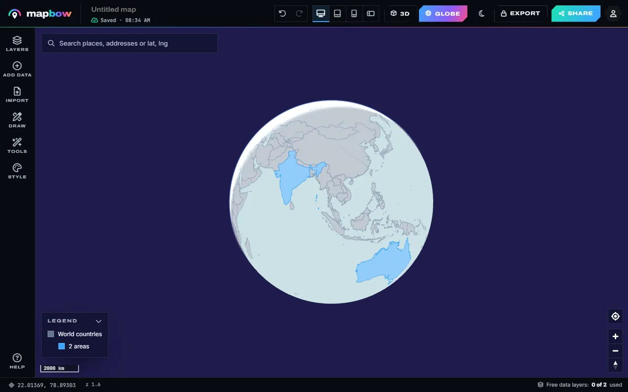
Step 2 Indigo space and the atmosphere glow. - Share the planet. The globe, its colour and the glow are saved with the map, so shared and embedded maps open the same way - and image and PDF exports use the same background.
Step 3 The finished globe map. - Light or dark. The studio itself has a light and a dark theme (the sun / moon button in the top bar); pick a space colour to match.
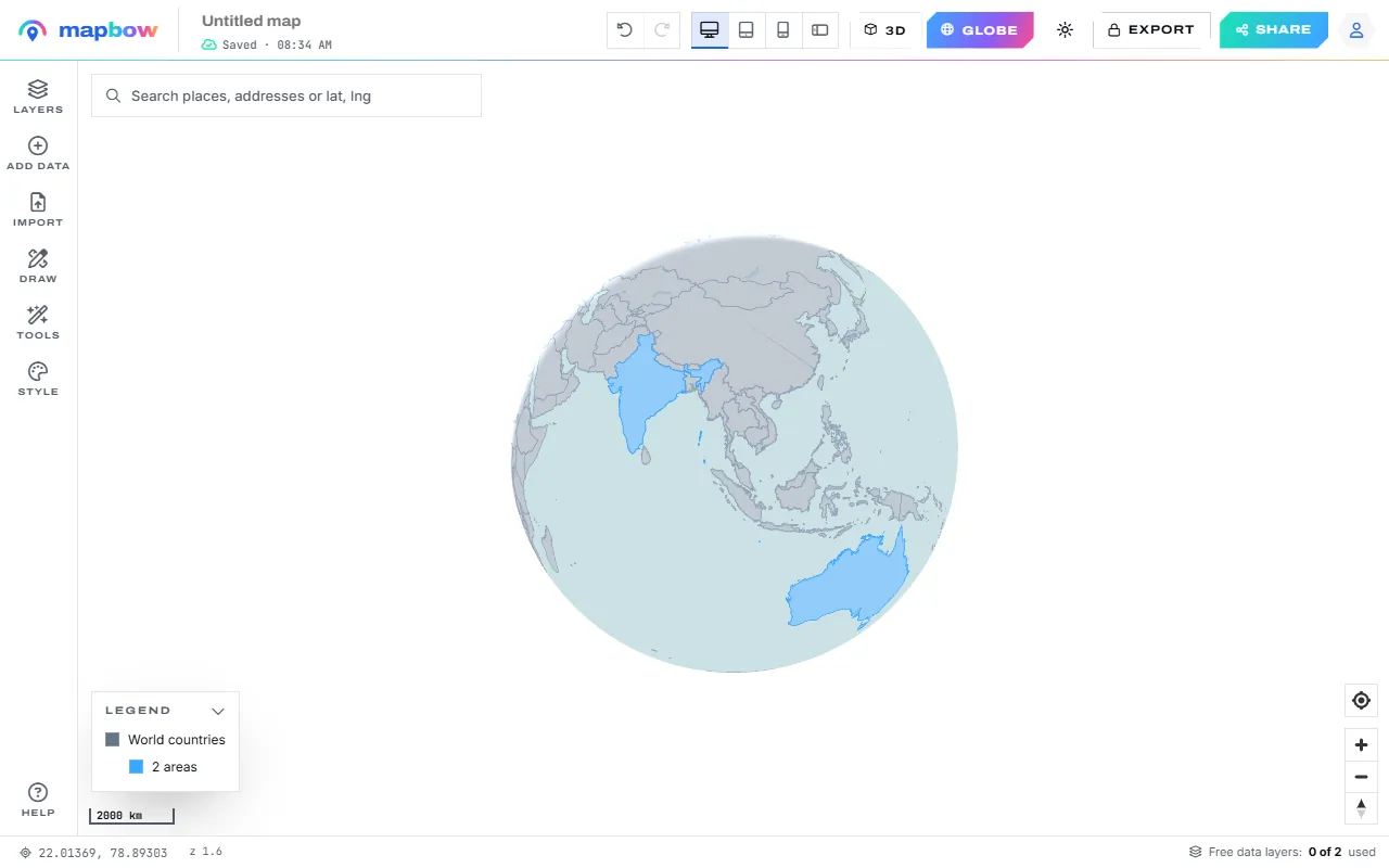
Step 4 A white background in the light theme.
Drag to spin the globe, scroll or pinch to zoom, and right-drag (or two fingers) to tilt it. The first swatch, Match the app, uses the page's own light or dark background instead of a fixed colour.
Picking a space colour
| Space colour | Looks like | Good with |
|---|---|---|
| Deep space, Black | A planet seen from orbit | Dark Matter or Satellite basemaps, bright data colours |
| Midnight, Indigo | Rich, slightly softer dark | Presentations, brand colours, glowing country fills |
| White, Paper | A clean, printed look | Positron or Light Gray basemaps, reports and PDFs |
| Sky, Sand | Friendly and light | Travel, education and websites with a light design |
| Your own colour | Matches your website exactly | Embedded maps - use your page's background colour |
The atmosphere glow looks best on dark space. On white or paper you may prefer to switch it off for a crisper edge.
When a globe beats a flat map
Flat web maps use the Web Mercator projection, which enlarges areas towards the poles. Greenland looks about as big as Africa, although Africa is about fourteen times larger; Canada and Russia look enormous. A globe shows every country at its true relative size and shape.
- World-scale data. Countries coloured by a value, worldwide offices, members or customers.
- Global links. Long-distance travel, shipping or a supply chain where the real shape of the earth matters.
- Polar regions. The Arctic and Antarctica look as they really are, not as stretched bands across the top and bottom.
- Presentations and websites. A slowly spun globe is an attention-grabbing header for a "where we work" page.
A flat map is still better when you need to see the whole world at once (a globe shows only one side), for detailed local maps (which flatten as you zoom in anyway), and when people need to compare places on opposite sides of the earth.
Adding colour and data to the globe
Everything on your map is drawn on the globe too.
- Colour countries. Add World countries (free) and use Tools › Colour regions: pick a colour, click countries to paint them, and give each colour a legend label in the inspector. The finished globe above shows India and Australia painted this way. See how to colour a map by region.
- Your own world data. Import a spreadsheet of locations, or a GeoJSON or KML of countries with values, then use Colour by field in the layer's Style tab for a world choropleth.
- Density. A heat map or hex bins extruded in 3D look striking on a spinning globe.
- Ready-made places. Data layers from Add data – airports, volcanoes, national parks – sit on the globe like any other layer.
- Drawings. Pins, lines, areas and text labels from Draw all stay on the globe.
Sharing and exporting a globe
Press Share and switch on Anyone with the link can view to get a link; sharing needs a free account. Embed on your website gives iframe code for WordPress, Squarespace, Wix, Webflow, Shopify, Notion or any HTML page, with options for the title card, legend, layer switches, search and scroll zoom – see how to embed a map on your website. Viewers can spin and zoom the globe themselves, and the embed updates when you edit the map.
For a still image, Export as PNG or PDF. The export uses your space colour as the background, which suits slides and printed reports. Exports unlock with any purchase.
For terrain and 3D buildings alongside the globe, see how to make a 3D map.
Frequently asked questions
Is the globe view free?
Yes. Globe view, the space colour and the atmosphere glow are free on every map.
How do I turn a flat map into a globe?
Open Style, find 3D & globe and switch on Globe view. Zoom out to see the whole planet.
Why does my globe look flat when I zoom in?
That is by design. As you zoom in, the globe smoothly becomes a normal map, which is easier to read at street and city level.
Can I change the background behind the globe?
Yes. Under Space around the globe, choose deep space, midnight, indigo, black, white, paper, sky, sand or any colour with the picker.
Can I embed a spinning globe on my website?
Yes. Press Share, open Embed on your website and copy the code. The embedded map opens as a globe with your colours.