How to Make a 3D Map Online
Create an interactive 3D map in your browser: tilt and rotate, raise the terrain, extrude buildings, use the globe view and add your own data. Free.
Updated · by the mapbow team
A 3D map adds depth: mountains rise, city buildings stand up and the whole planet can spin as a globe. It is brilliant for hiking routes, ski resorts, property in hilly areas, city tours and any presentation that needs a "wow". You can make one in your browser in minutes – no 3D software needed.
Turn on 3D, step by step
- Find your place. Open the studio, then search for the place or pan to it. Any basemap works; Satellite, Topographic and Voyager look best in 3D.
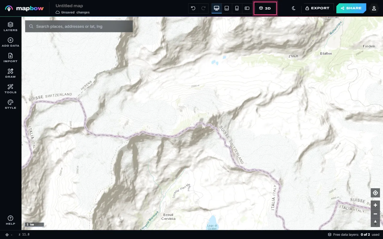
Step 1 The Matterhorn, flat. The 3D button is in the top bar. - Press 3D. Press 3D in the top bar. The map tilts and the terrain rises; drag with the right mouse button (or two fingers) to tilt and turn it.
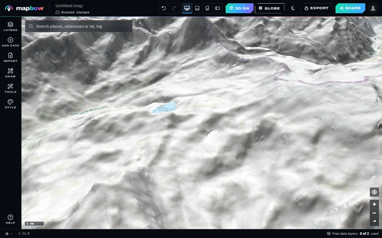
Step 2 The same view in 3D terrain. - Exaggerate the relief. Open Style to change the basemap (here Satellite) and, under 3D & globe, the terrain exaggeration, from 0.5× to 3×.
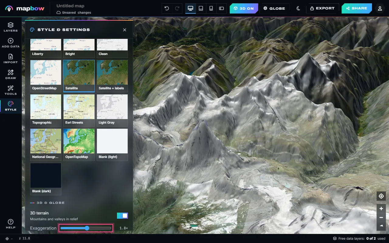
Step 3 Satellite imagery with 1.8× terrain. - Buildings in every city. 3D also raises the buildings when you zoom into a city - New York, London, Sydney, anywhere OpenStreetMap has them.
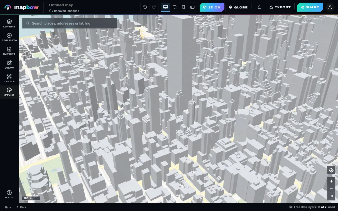
Step 4 Midtown Manhattan in 3D.
The 3D button turns on terrain and buildings together. To use just one of them, switch 3D terrain or 3D buildings on or off separately in Style › 3D & globe. On a laptop without a right mouse button, hold Ctrl and drag to tilt and rotate. Press 3D again to go back to a flat map.
What appears in 3D
| Feature | What you see | Best zoom |
|---|---|---|
| Terrain | Mountains, valleys and coastlines in relief, with hillshading | Regional to local |
| 3D buildings | City buildings extruded to their height where known | Street level (zoom 15+) |
| Globe | The whole earth as a sphere, without polar stretching | World and continent |
Choose the right basemap for 3D
- Satellite imagery draped over terrain is the most realistic – ideal for outdoor and property maps.
- Topographic and OpenTopoMap combine contours with relief for hiking and planning.
- Light or dark vector styles such as Positron, Voyager or Dark Matter make 3D buildings look crisp and architectural for city maps.
Adding your data in 3D
Everything you add works in 3D: pins, routes, polygons and data layers sit on the terrain. Areas can stand up too: select an area layer and turn on Extrude in 3D in its Style tab, then choose a number field under Height by – for example a count from Tools › Count in areas or Tools › Hex bins. Some combinations that look fantastic:
- A hiking route drawn with the route tool over satellite terrain, with mountain peaks and viewpoints.
- National park boundaries over a mountain range.
- A city walking tour among 3D buildings, with museums and cafes.
- A volcano map using the volcanoes layer on the globe.
When 3D helps – and when it doesn't
3D is not always better. Tilting a map hides things behind hills and buildings, and distances look uneven because near things look bigger than far things.
- Use 3D for terrain-driven stories, outdoor routes, views and line-of-sight, skylines and presentations.
- Use 2D for measuring, comparing regions, dense point data and anything people need to read accurately.
Viewers of your shared map have their own 3D button, so they can switch between 2D and 3D themselves – you can offer both.
Performance tips
- 3D asks more of the device. On older phones, keep layer counts modest and turn on Cluster nearby points for big point layers.
- Check the phone preview in the top bar before sharing.
- Moderate terrain exaggeration (1–1.5×) loads and renders faster than extreme values.
Making a great 3D map: a quick recipe
- Choose a place with relief. Mountains, canyons, coastlines and dense skylines show 3D at its best.
- Pick the Satellite basemap in Style for landscapes, or a light vector style for cities.
- Press 3D and set terrain exaggeration in Style › 3D & globe to around 1.3× (the default) for natural-looking hills.
- Add your story. Draw a route, drop pins at key points with photos, and add one relevant data layer such as peaks or campsites.
- Find the angle. Tilt to 50–60° and rotate so the route or skyline runs across the frame rather than straight away from the viewer.
- Save the view as the start view and check the phone preview.
3D map ideas
| Map | Basemap | Layers |
|---|---|---|
| Hiking or ski trip | Satellite | Route, peaks, viewpoints, campsites |
| City walking tour | Light vector | Route, museums, cafes, 3D buildings |
| Property in hilly terrain | Satellite | Drawn boundary, schools nearby |
| Volcanoes of a region | Topographic | Volcanoes, national parks |
| Global network | Dark Matter | Major cities on the globe |
The globe view
Flat web maps stretch areas near the poles – Greenland looks as big as Africa, although Africa is about fourteen times larger. The globe view removes that distortion, which makes it the honest choice for world-scale maps of countries, flight routes or global networks. Turn it on with the Globe view switch in Style › 3D & globe; the map zooms out to show the whole planet, which you can spin. You can also choose the Space around the globe colour and add an Atmosphere glow. As you zoom in, the globe smoothly becomes a regular map. The globe map guide goes through it step by step.
Sharing 3D maps
When you share or embed a 3D map, viewers get the same view you saved and can tilt and rotate it themselves. They can also press 3D to switch it off if they prefer a flat view for reading details.
Frequently asked questions
Is making a 3D map free?
Yes. 3D terrain, 3D buildings and the globe view are free on every map.
Can I share a 3D map?
Yes. Shared and embedded maps keep 3D, and viewers can tilt and rotate them.
Why don't I see 3D buildings?
Zoom in to street level in a city, and check 3D buildings is on in Style › 3D & globe. Buildings appear where their footprints are mapped; coverage is best in larger cities.
How do I tilt the map on a laptop trackpad?
Hold Ctrl and drag, or use the compass control on the map.
How do I get the globe?
Turn on Globe view in Style › 3D & globe. Zoomed out, the map becomes a planet you can spin.
Can I export a 3D view?
Yes. PNG and PDF exports capture the current view, including tilt and terrain, with any data layer purchase.