How to Measure Distance on a Map
Measure straight-line and multi-point distances on a map in km or miles, understand great-circle distance, and avoid the common mistakes. Free tool included.
Updated · by the mapbow team
Measuring distance on a map sounds simple – and with the right tool it is. But "distance" can mean several different things: straight-line, along a path you trace, or the driving distance a navigation app quotes. This guide shows how to measure each in mapbow and explains which one you actually need.
Measure a distance, step by step
- Pick Distance. In the studio open Tools and choose Distance, or just press M. You can also use the map distance calculator. Units (metric, imperial or nautical) are set at the bottom of the same panel.
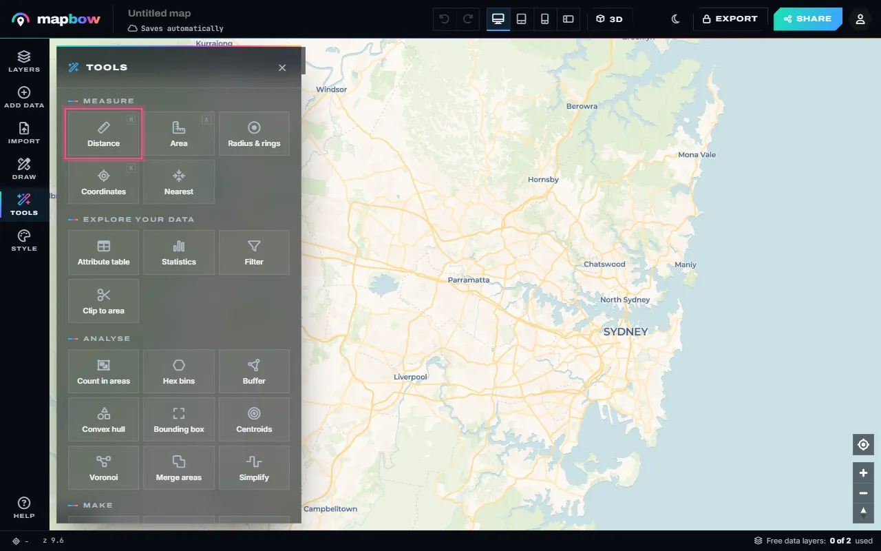
Step 1 Tools › Distance. Press M at any time. - Click along the way. Click the start point, then each point of the route. Every leg is labelled, and the card shows the total in your units and the other system. Press Enter or double-click to finish, Backspace to undo a point.
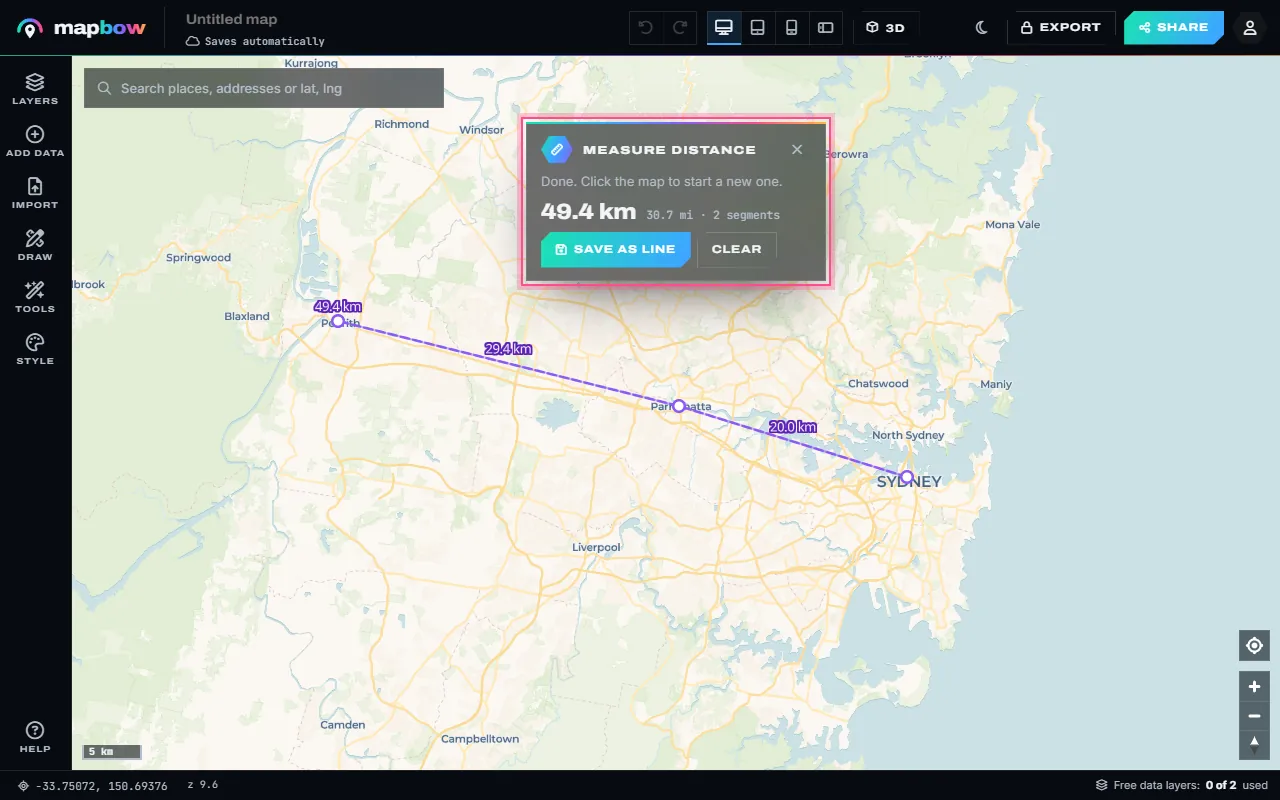
Step 2 Sydney → Parramatta → Penrith: each leg and the total. - Measure an area. Choose Area (A) and click round the shape. The card shows the area and the perimeter. Save as area keeps it on the map as a shape you can label and share.
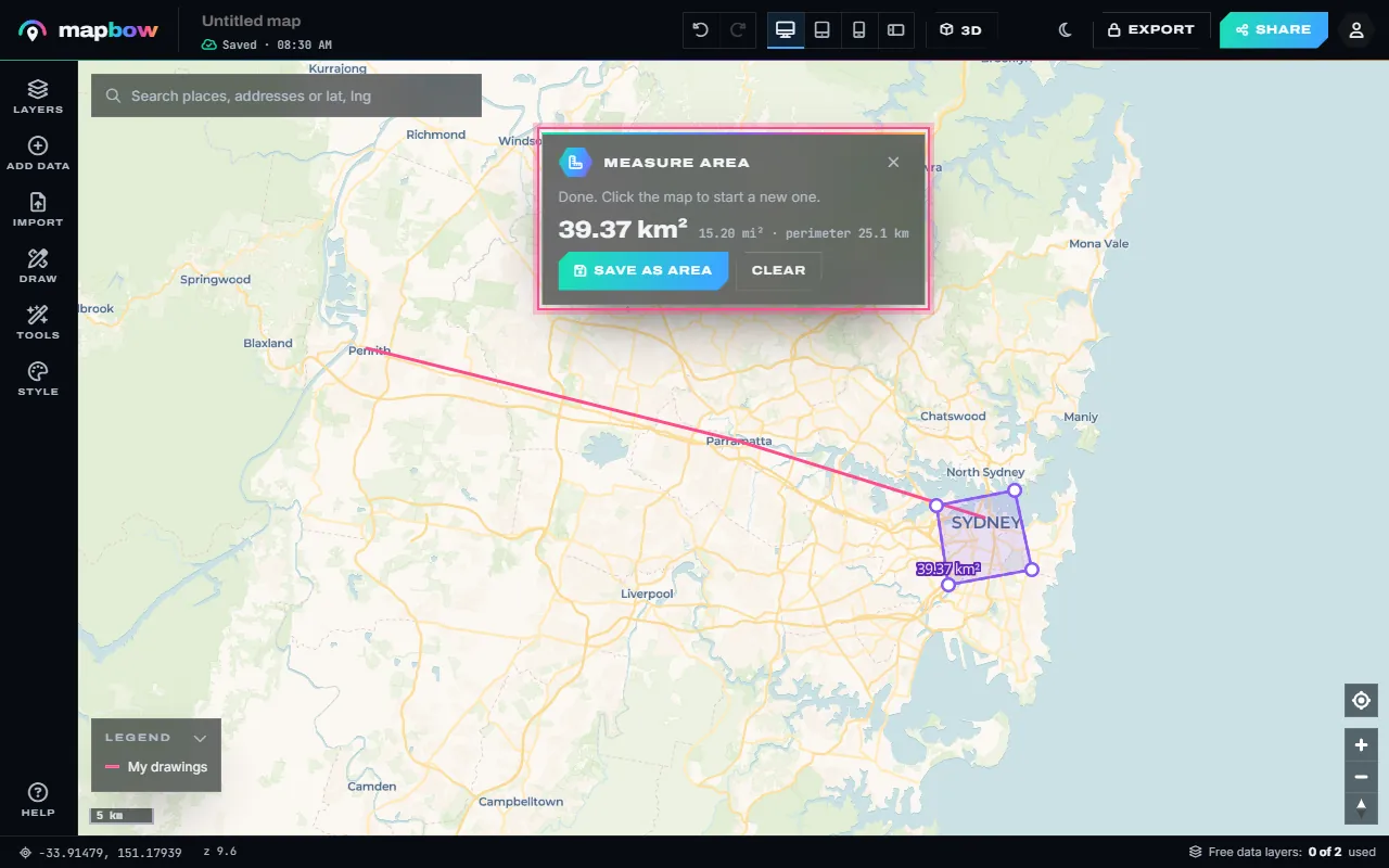
Step 3 An area with its size and perimeter. - Keep it and edit it. Save as line and Save as area turn a measurement into an ordinary shape: drag the white handles to reshape it and the length, area and perimeter update.
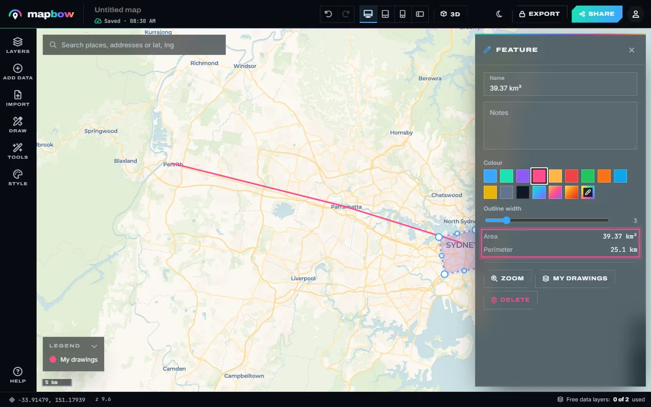
Step 4 A saved area with its measurements in the inspector.
With just two clicks you get the "as the crow flies" distance – the shortest path over the earth's surface between two points. Search for a place first if you need to find the start or end.
Measure along a path
To measure a walking loop, a hiking trail, a fence line or a cable run, keep clicking along the way. Each click adds a leg; every leg gets its own label and the card keeps the running total. Zoom in on bends – the more points you place, the closer the measurement follows the real line. Placed a point in the wrong spot? Press Backspace to remove it, or save the line and drag its white handles afterwards.
Great-circle distance, in plain English
The earth is round, but screen maps are flat. On the common Web Mercator projection, the shortest route between two distant points is not a straight line on screen – it is a curve (a "great circle"). That is why flight paths look bent on maps.
mapbow measures geodesically, along the earth's surface, so the number you see is the true distance no matter where on the map you measure or how the map is projected. Tools that measure in screen pixels can be wildly wrong far from the equator.
| Route | Approx. great-circle distance |
|---|---|
| London → New York | about 5,570 km / 3,460 mi |
| Sydney → Melbourne | about 713 km / 443 mi |
| Los Angeles → Chicago | about 2,800 km / 1,745 mi |
| Paris → Berlin | about 880 km / 545 mi |
Straight-line vs. driving distance
Driving distance follows roads, so it is always longer – typically 20–40% more than straight-line, and far more where mountains, lakes or coastlines force detours. Use straight-line distance for:
- Comparing how close places are.
- Radius and catchment analysis (radius map).
- Aviation, marine and drone planning.
- Measuring things you draw yourself: fences, trails, property sides.
To estimate road distance, trace the road with many clicks – the total will be close to what a sat-nav reports.
Find the nearest place and its distance
Often the real question is "how far is the nearest…?". Add a data layer such as hospitals, pharmacies, train stations or fuel stations, open Tools › Nearest, pick the layer and click anywhere on the map. mapbow draws a line to the closest place, labels it with the distance and names the place in the card.
Measuring area and perimeter
Close a shape and you have an area. Use Tools › Area (A) or the area calculator. In metric units you get square metres, hectares or km²; in imperial units, acres or square miles – plus the perimeter. Any drawn area shows the same measurements in the inspector when you select it.
Common mistakes
- Measuring zoomed out. A click at country scale can be hundreds of metres off. Zoom in on each end.
- Mixing units. Double-check miles vs kilometres before you quote a number. The card always shows both systems.
- Treating straight-line as travel distance. Add a margin, or trace the route.
- Trusting on-screen rulers. A printed scale bar is only correct at one latitude on Mercator maps.
Measuring tips by use
| Use | Basemap | Tip |
|---|---|---|
| Fence or boundary line | Satellite | Click every corner post; zoom right in |
| Running or walking loop | Street map | Follow path bends with extra clicks |
| Hiking trail | Topographic | Turn on 3D to see the climbs |
| Flight or sailing leg | Any | Switch the units to nautical |
| Distance between two cities | Any | Search each city and click their centres |
Measuring between many places
When you need distances from one point to many – for example from a warehouse to every customer – measuring one by one is slow. Import the customers, then use Tools › Nearest, or draw radius rings around the warehouse (type several distances, such as 5, 10, 20) and run Tools › Count in areas to sort customers into distance bands at a glance.
Elevation and slope
Map distances are horizontal. On steep terrain the distance you actually walk is a little longer, and much more tiring. Press 3D in the top bar to see the shape of the land along your line, and allow extra time for climbs.
Frequently asked questions
How do I measure distance between two points on a map?
Open Tools › Distance (or press M), click the first point, click the second point, then press Enter or double-click to finish. The distance appears in your units and the other system.
Can I measure in miles?
Yes. Set the units to metric (metres and kilometres), imperial (feet and miles) or nautical (nautical miles) at the bottom of the Tools panel.
What is "as the crow flies"?
The shortest distance between two points over the earth's surface, ignoring roads and obstacles.
Can I save a measured line?
Yes. Press Save as line (or Save as area) to keep it on the map as a shape you can label, reshape, share or embed.
Is the distance calculator free?
Yes, with no account required.